Satellite Maps
Upgrade to Pro to access the best imagery for your hunt area across multiple satellite providersHuntStand offers the most satellite imagery options of any hunting app. Available satellite base maps include:
- Mapbox satellite hybrid: blended and color-corrected
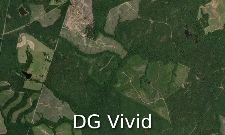
- Digital Globe Vivid satellite: usually less than 1.5 years old, vivid colors
- Google satellite and hybrid: high resolution across multiple imagery sources, with or without contour lines
Additional base map options
In addition to offering the largest variety of satellite and aerial imagery, HuntStand also offers numerous specialized base maps
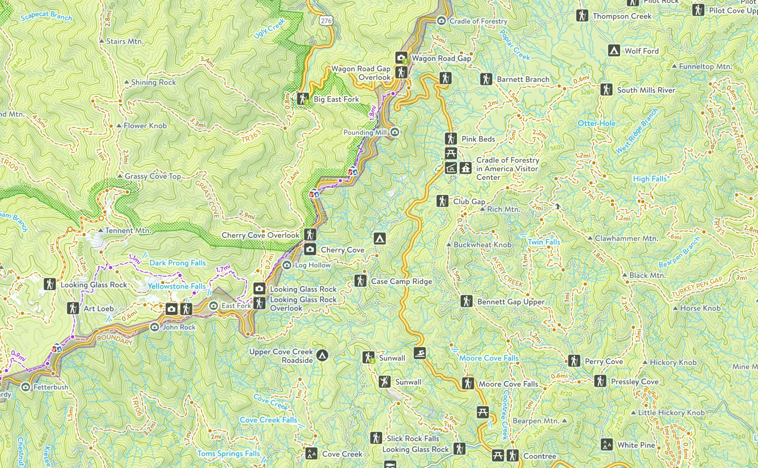
Natural Atlas
The most comprehensive and accurate map of the United States' outdoors. With this layer you will have access to a highly detailed topo map overlaid on top of trails, ATV and 4X4 roads, forest roads, campgrounds, parks, natural points of interest, access locations, and more.
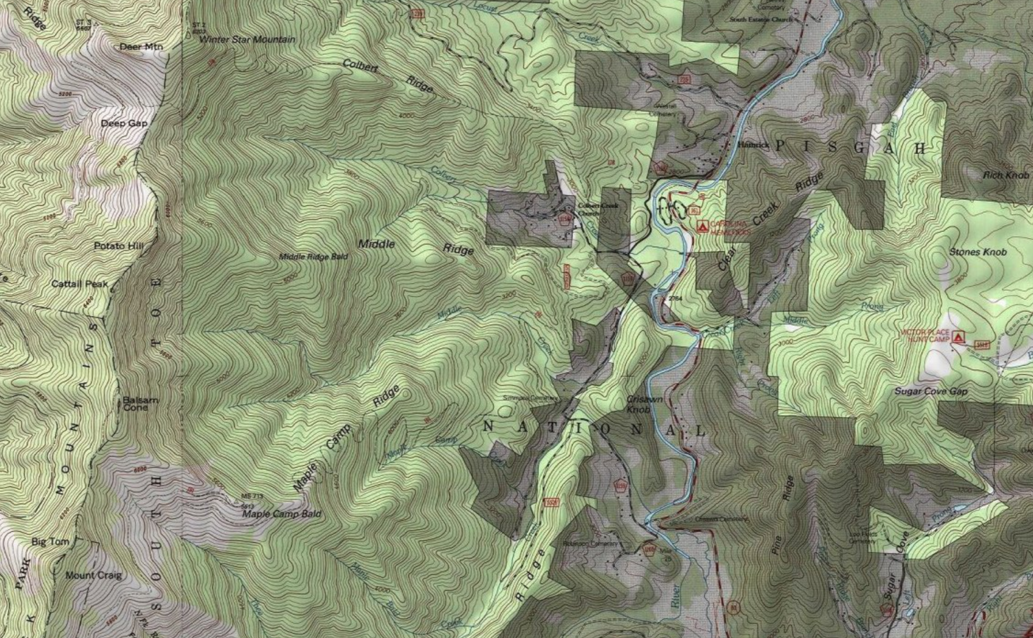
US Geological Survey Topographic Quad
USGS has been mapping the US since 1879, and continues to provide some of the best known GIS derived topographic maps.
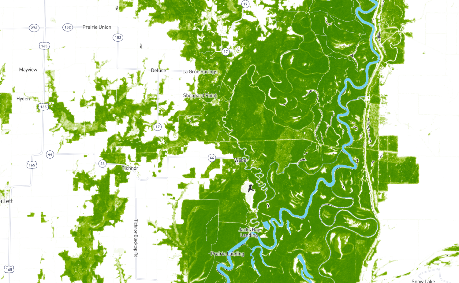
TerraPulse Tree Cover
Utilizing the power of NASA satellites with climate monitoring technology, enjoy exclusive access to the most comprehensive tree cover and vegetation map ever offered to the public. This layer distinguishes between trees and other types of vegetation that support big game habitat suitability.