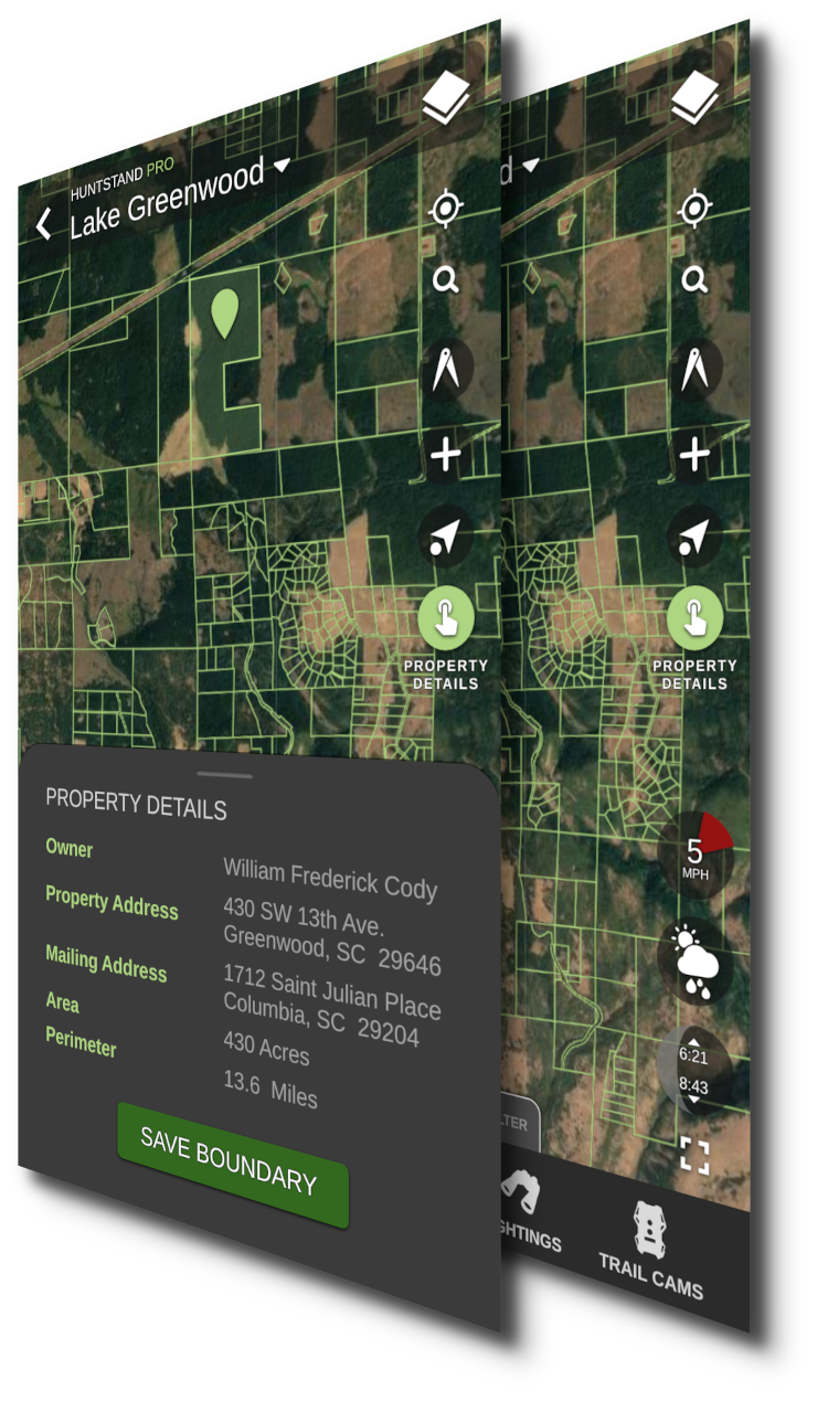
Private and Public Lands
Map private and public land with confidence using the most comprehensive and complete maps for the US and CanadaPrivate Land
- High accuracy property boundaries
- Up-to-date owner name for private and public land parcels
- Property address
- Owner mailing address
- Property area and perimeter length
- Save and share boundaries
- Searchable by address or coordinates
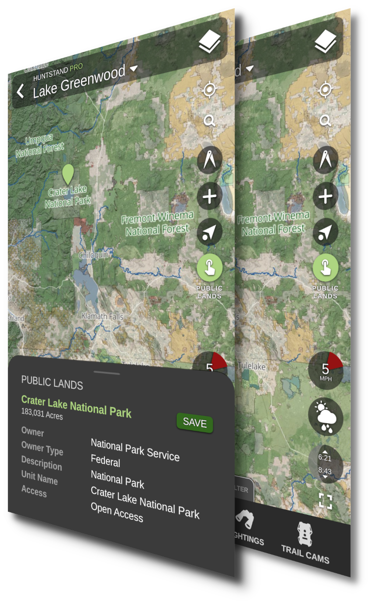
Public Land
- Forest Service
- National and State Parks
- Bureau of Land Management
- U.S. and State Fish & Wildlife
- U.S. and State Department of Natural Resources
- Show more...
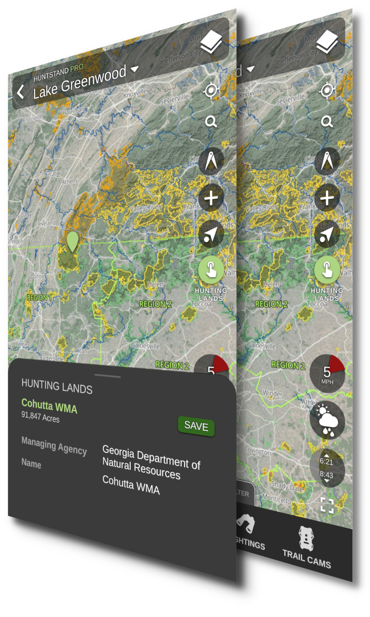
Hunting Lands
- Wildlife Management Areas
- Department of Natural Resources
- Department of Fish and Wildlife
- Game Management Units, Zones, and Districts
- Show more...
Private Land Coverage for the United States and Canada
HuntStand offers property boundaries and property ownership info for 99% of the US, and property boundaries for much of Canada. Tap below to view our coverage map.
Public Land Coverage for the Entire U.S.
HuntStand combines data from federal, state, and local sources to provide the most comprehensive public lands data.
Hunting Land Coverage for 46 States
HuntStand combines over 400 data sources from state and local agencies. Expanded coverage coming soon to Illinois, Arizona, Hawaii, and New Hampshire.
Zoom out to explore new regional hunting opportunities
Zoom in to view detailed contour lines, hydrography, and satellite imagery
High detail maps of hunting areas
Vibrant colors help distinguish land type boundaries at a glance
Detailed zone maps show regulatory boundaries
Plan access with forest, logging, and unimproved roads
Plan your next hunt using HuntStand's incredible maps package